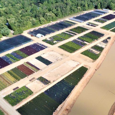
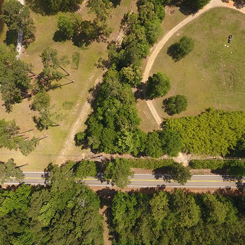
Enhancing Natural Gas Pipeline Monitoring with Drone Technology
Advanced Robotics and Drone Use in Marine Vessel Assessment and Maintenance
Development of an Advanced Amphibious Drone for Marine Exploration and Monitoring
Innovative Coastal Land Management through Technology in Southeast Louisiana
Advanced Drone Technology in Crocodilian Nest Assessment with Biologist Ted Joanen
Enhancing Natural Gas Pipeline Monitoring with Drone Technology
In a collaborative effort with our strategic partner CAVU, we embarked on a pioneering project to conduct low-altitude gas monitoring flights over natural gas distribution facilities across Texas, Louisiana, and Oklahoma. Our expert environmental team, along with seasoned pilots, leveraged advanced environmental synthesis techniques. This approach enabled the provision of both real-time and summarized data streams, crucial for addressing emerging requirements in gas monitoring.
This innovative service became feasible after developing a custom platform. We integrated sophisticated gas detection systems with infrared (IR) sensors and other onboard diagnostic tools, enhancing our photogrammetry mapping capabilities. This integration allowed for a comprehensive and detailed analysis of the pipeline infrastructure, setting a new standard in environmental monitoring and safety for the natural gas industry.
Advanced Robotics and Drone Use in Marine Vessel Assessment and Maintenance
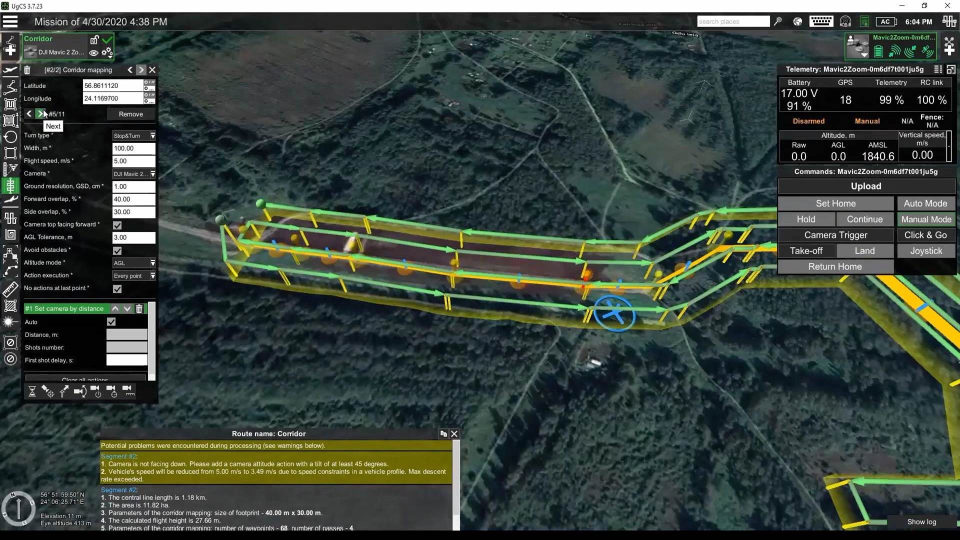
In a collaborative project with DMES, our team has pioneered the use of robotics and drones for comprehensive assessments and maintenance within the confined spaces of marine vessels. Utilizing state-of-the-art technology, our approach involved capturing high-quality photographs in low-light conditions, conducting detailed LIDAR mapping, and taking precise multi-gas readings.
The primary goal of this initiative was to pilot test our capabilities in two critical areas: emergency response assessments and routine cleaning and survey operations. This innovative application of drone and robotic technology not only enhanced the efficiency and safety of marine vessel assessments but also paved the way for more advanced, data-driven approaches in marine maintenance and survey efforts.
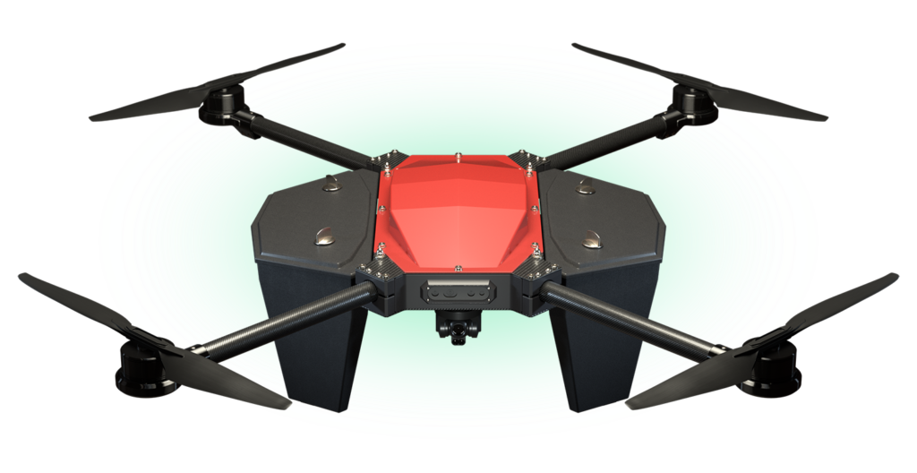
Development of an Advanced Amphibious Drone for Marine Exploration and Monitoring
In a groundbreaking partnership with Seahawk Robotics of Canada, we have dedicated years to R&D, culminating in the creation of a highly sophisticated amphibious drone. This drone is not only reliable and easily deployable but also features an advanced winch system capable of deploying a separate ROV (Remotely Operated Vehicle) for underwater exploration and surveys. Centered around the challenging mission of deploying intelligent payloads, this platform is designed to operate in some of the most unforgiving environments on the planet. Its applications are incredibly diverse and virtually limitless. They range from conducting port and near-water infrastructure assessments to performing at-sea evaluations for the oil and gas industry, examining dams, and supporting a variety of other marine applications. These include acoustic monitoring and extensive marine research.
The versatility and robustness of our amphibious drone platform have opened new horizons in marine exploration and environmental monitoring, demonstrating our commitment to advancing technology in the service of critical environmental and industrial needs.
The primary goal of this initiative was to pilot test our capabilities in two critical areas: emergency response assessments and routine cleaning and survey operations. This innovative application of drone and robotic technology not only enhanced the efficiency and safety of marine vessel assessments but also paved the way for more advanced, data-driven approaches in marine maintenance and survey efforts.

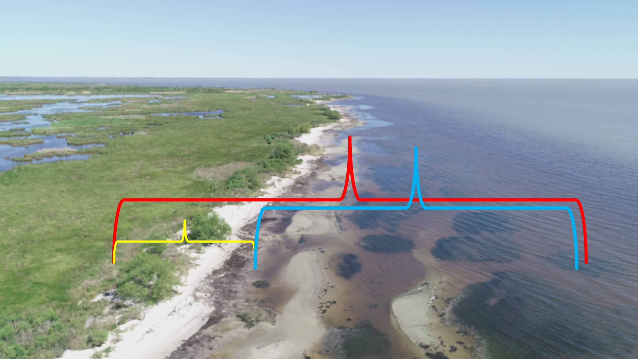
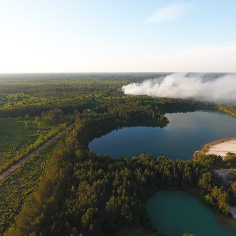
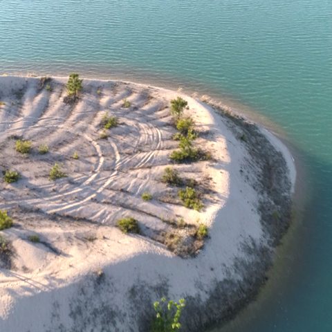
Innovative Coastal Land Management through Technology in Southeast Louisiana
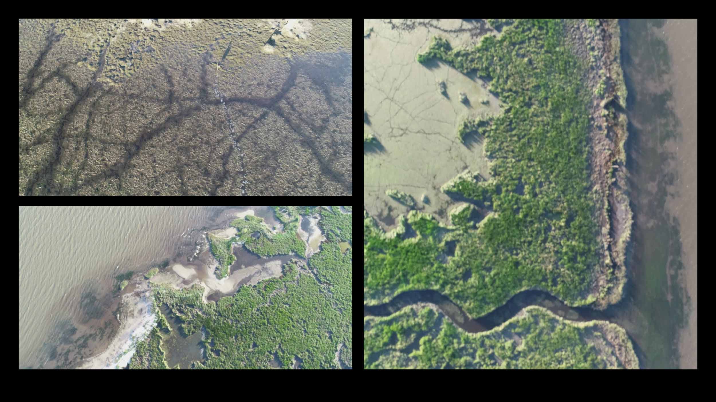
Dronetech has embarked on a critical initiative to support private landowner management of coastal lands in Southeast Louisiana. This project involves the creation of a comprehensive database to augment the efforts of various agencies in the region. Utilizing advanced technologies such as LIDAR, alongside ground truthing and benchmarking, our team has been meticulously mapping the fragile beach systems adjoining freshwater marshes and brackish estuarine bays.
This ongoing effort is notable for its cost-effective application of cutting-edge technology. The mission is to provide detailed, season-to-season and year-to-year insights into various environmental factors. These include aquatic vegetation dynamics, the presence of invasive marsh species, sand budgets, and other elements crucial to maintaining a self-healing beach ecosystem. These sensitive environments, affected by both weather conditions and human activities, are at the core of our study.
Our aspiration with this project is to demonstrate to state and federal governments the potential for enhancing these natural systems. We aim to show that they can be bolstered without resorting to levees, hard infrastructure, or other forms of environmental armoring, thereby preserving their intrinsic ecological balance.
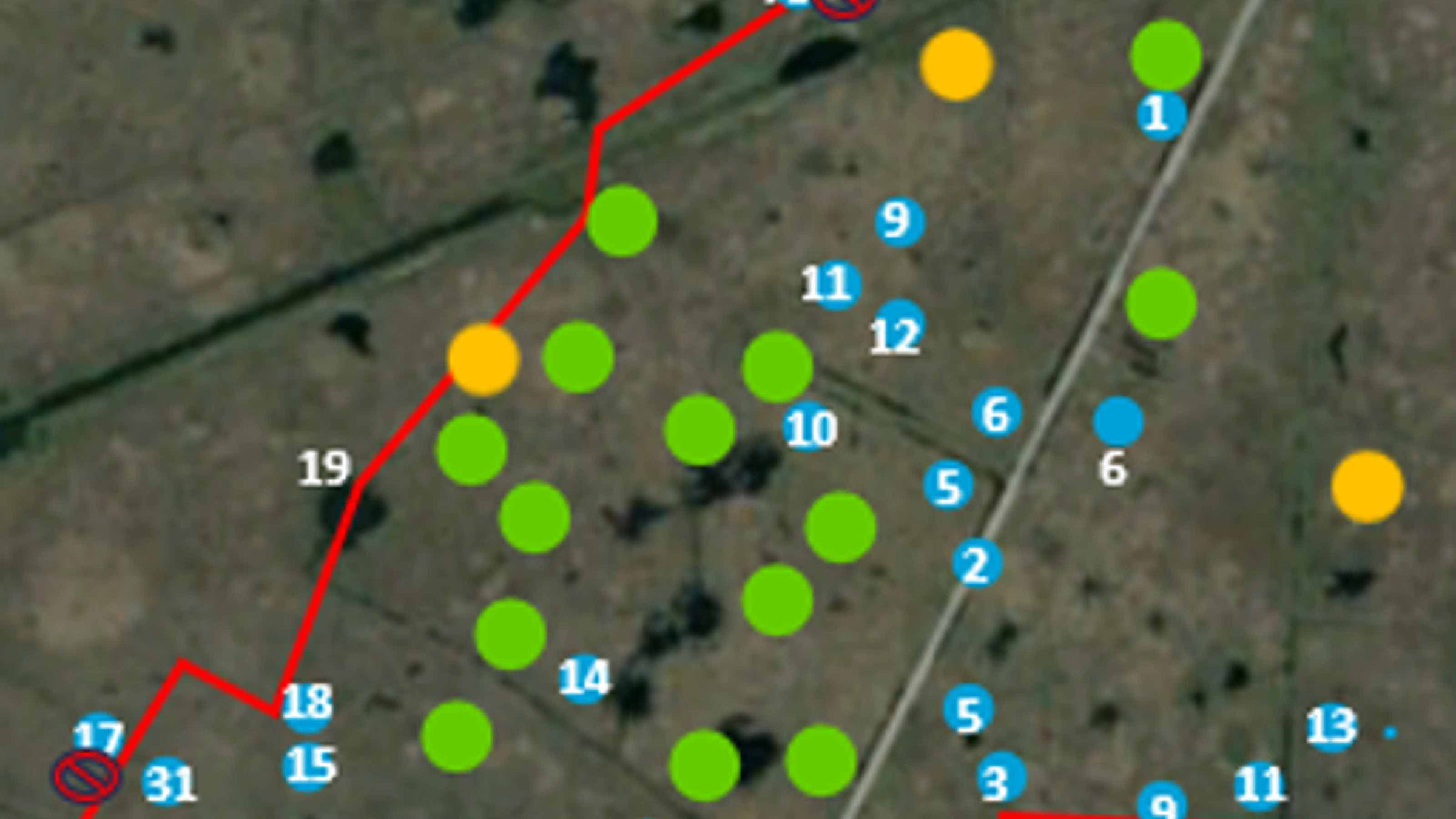
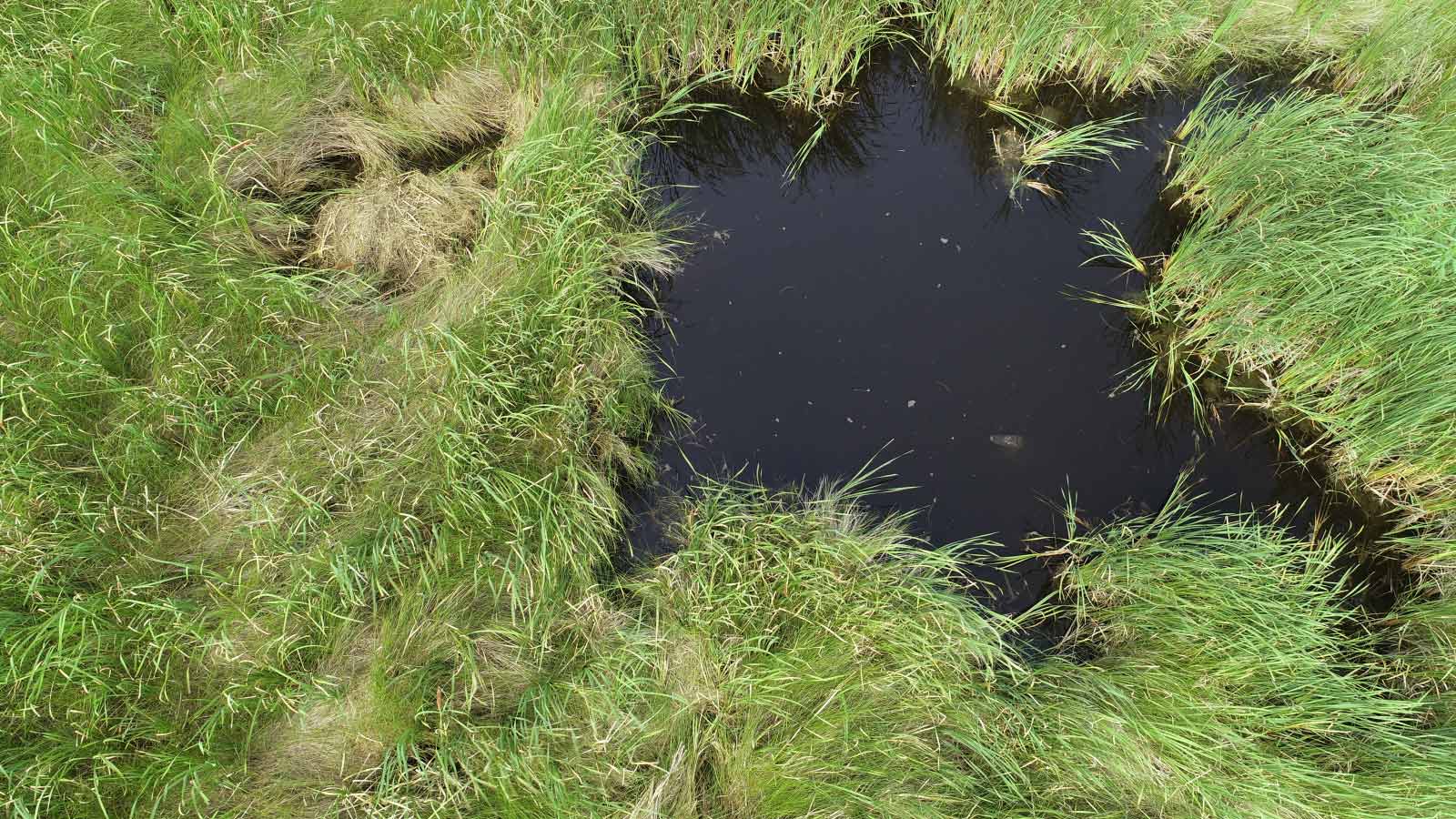
Advanced Drone Technology in Crocodilian Nest Assessment with Biologist Ted Joanen
In a collaborative venture with renowned crocodilian biologist Ted Joanen, our team has embarked on a mission to revolutionize the assessment of crocodile nests in the marshes of Southwest Louisiana. This ongoing project aims to validate nest counts obtained via helicopter surveys, analyze year-to-year variations in marsh conditions, and develop an AI-powered algorithm. This algorithm is designed to identify nesting behaviors and nest shapes, enabling rapid and accurate location of nests that are challenging to detect with the naked eye.
Looking ahead, our flights will also play a crucial role in monitoring invasive plant species and tracking changes in nesting patterns against historical data. This innovative approach is made possible by utilizing customized camera systems, equipped with infrared (IR) technology and high-resolution video, mounted on enterprise drones developed in partnership with CAVU and Drontetech.
By combining cutting-edge drone technology with expert biological insight, this project not only enhances our understanding of crocodilian nesting habits but also sets a new benchmark for ecological research and conservation efforts.
This ongoing effort is notable for its cost-effective application of cutting-edge technology. The mission is to provide detailed, season-to-season and year-to-year insights into various environmental factors. These include aquatic vegetation dynamics, the presence of invasive marsh species, sand budgets, and other elements crucial to maintaining a self-healing beach ecosystem. These sensitive environments, affected by both weather conditions and human activities, are at the core of our study.
Our aspiration with this project is to demonstrate to state and federal governments the potential for enhancing these natural systems. We aim to show that they can be bolstered without resorting to levees, hard infrastructure, or other forms of environmental armoring, thereby preserving their intrinsic ecological balance.

![]()
1-833-DRONEON
(1-833-376-6366)
email: contact@dronetech.solutions